Atlantic Hurricane Season 2024: NOAA Reports on Hurricane Beryl

The National Hurricane Center has completed and released its Tropical Cyclone Report on 2024’s Hurricane Beryl, which was the earliest Category 5 hurricane of record in the Atlantic basin and caused major damage to the Caribbean Windward islands of Grenada and St. Vincent and the Grenadines.
Published 3 months ago
Source: National Hurricane Center
2024 Atlantic Season Tropical Cyclone Reports
The National Hurricane Center’s Tropical Cyclone Reports contain comprehensive information on each tropical cyclone, including synoptic history, meteorological statistics, casualties and damages and the post-analysis best track (six-hourly positions and intensities). Tropical cyclones include depressions, storms and hurricanes.
Beryl – A Major Early Season Hurricane
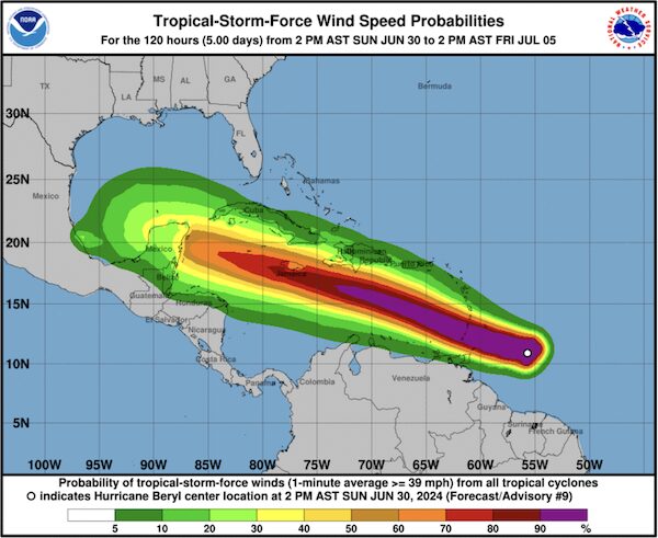
Hurricane Beryl was an a climatologically early Cabo Verde hurricane, becoming the earliest Category 5 hurricane of record in the Atlantic basin on the Saffir-Simpson Hurricane Wind Scale (SSHWS). It passed through the Windward Islands of the Caribbean as a major hurricane causing severe damage and later made landfall as a hurricane on the Yucatan Peninsula of Mexico and then the coast of Texas. The hurricane was directly responsible for 34 deaths.
Beryl formed from a tropical wave that moved westward from the coast of Africa on 23
June, 2024 accompanied by a disorganized area of showers and thunderstorms. The wave moved generally westward across the eastern tropical Atlantic for the next few days with little
development. The associated convection first showed signs of organization early on 27 June,
and by early on 28 June a better-defined vorticity center had formed with increasingly organized
convection. Continued development led to the formation of a tropical depression near 1200 UTC
28 June about 1200NM east of Barbados.
Beryl’s maximum sustained winds at landfall on Carriacou Island, Grenada, are estimated
at 120 kt (Category 4 on the SSHWS) based on aircraft wind data. No reliable surface wind
observations are available from this area. Hurricane conditions occurred over portions of Grenada and the Grenadine. Islands, with the Bishop International Airport on Grenada reporting sustained winds of 80 kt and a gust of 105 kt at 1600 UTC 1 July.
Tropical Storm Conditions
Tropical storm conditions occurred elsewhere on the islands of the southeastern Caribbean, including Barbados, Tobago, St. Vincent, St. Lucia, and Martinique. The strongest winds observed in these areas were from the Hewanorra International Airport on St. Lucia, which reported sustained winds of 57 kt at 1139 UTC 1 July and a peak gust of 72 kt. Wind gusts of tropical-storm force were reported elsewhere in the Lesser Antilles as far north as Guadeloupe, St. Barthelemy and St. Martin.
Continuing west-northwestward, the center passed south of the Cayman Islands early on
4 July with the maximum sustained winds decreasing to near 90 kt. A few hours later, Beryl re-
intensified but this re-strengthening was short-lived and the system rapidly weakened to a category 1 hurricane by the time it made landfall on the Yucatan Peninsula of Mexico just northeast of Tulum at 1100 UTC 5 July.
Beryl further weakened over the Yucatan Peninsula and then moved northwestward across the southwestern and western Gulf of Mexico on 6 July. The cyclone regained hurricane strength around 0400 UTC 8 July as it approached the Texas coast and rapidly strengthened to an intensity of 80 kt before making landfall near Matagorda, Texas, at 0840 UTC that day. The center then moved northward and north- northeastward, passing over the western side of the Houston metropolitan area between 1200 and 1600 UTC before moving farther inland into eastern and northeastern Texas. Beryl weakened to a tropical storm while passing near Houston, and it weakened to a tropical depression over northeastern Texas near 0000 UTC 9 July.
For the full report on Beryl, please visit: www.nhc.noaa.gov/data/tcr/AL022024_Beryl.pdf
Reports are also available on Hurricanes Debby, Isaac and Leslie as well as Tropical Storms Alberto, Chris, Gordon, Joyce, Nadine and Patty.
………………………………
Related News
- Hurricane Beryl Recovery Efforts Continue
- A Silver Lining from Trinidad & Tobago
- Hurricane Beryl: Aid for both locals and cruisers
- Caribbean, Hurricane Beryl’s Destructive Path – How You Can Help
………………………………
Related Reports:
………………………………
Related Links:
- Doyle Guides Beryl information
- Caribbean Compass Hurricane Beryl Page
- Natural Disasters: Advice for Cruisers Who Want to Help
- National Hurricane Center
- The Facebook page Hurricane Beryl – Grenada and Carriacou Updates has lots of images and information.
………………………………
Find out all news, reports, links and comments posted on Noonsite, plus cruising information from around the world, by subscribing to our FREE monthly newsletter. Go to https://www.noonsite.com/newsletter/.
Related to following destinations: Anse Marcel, Barbados, Bequia, Blue Lagoon, Bridgetown, Britannia Bay - Lovell, Canouan, Castries, Charlotteville, Chateaubelair, Clarkes Court Bay, Grenada, Grenville, Gustavia, Hog Island, Kingstown, Marigot Bay (St. Lucia), Marigot Bay (St. Martin), Mayreau, Mt Hartman Bay, Mustique, Ottley Hall, Oyster Pond, Petit Martinique, Port Egmont (Le Phare Bleu Bay), Port Elizabeth (Bequia), Port St. Charles, Prickly Bay, Rodney Bay, Sauteurs, Scarborough (Tobago), Soufriere, St. Barts, St. Davids, St. George's, St. Lucia, St. Martin, St. Vincent, St. Vincent & the Grenadines, Store Bay, The Grenadines, Tobago, Tobago Cays, Trinidad & Tobago, True Blue Bay, Tyrell Bay & Hillsborough (Carriacou), Union Island, Vieux Fort, Wallilabou Bay, Young Island Cut
Related to the following Cruising Resources: Hurricanes and Tropical Cyclones, Weather
Comments